Restoration Projects
Riparian Nearshore Wildlife Habitat within the Thunder Bay Area of Concern (AOC)
Access the online interactive story map for more information:
Thunder Bay was identified as an Area of Concern (AOC) under the Canada-U.S. Great Lakes Water Quality Agreement because of environmental impacts along the Thunder Bay waterfront and adjoining tributaries from industrial activities (including from the pulp and paper industry) and urban development. Loss of Fish and Wildlife Habitat is one of the original identified impairments that remains within the Thunder Bay AOC, due to lost or degraded wetlands and riparian and shoreline habitat. In support of Environment and Climate Change Canada's objective of addressing one of the last remaining beneficial use impairments within the Thunder Bay Area of Concern (AOC), Lakehead Region Conservation Authority carried out desktop analysis and field investigations to assess riparian and nearshore habitat health within the AOC. Ecosite mapping, wetland evaluations, and data collected in the field was combined and analyzed to score and rank areas based on their habitat value, thereby determining the overall health and condition of wildlife habitat within the Thunder Bay AOC. The collected data and data interpretation was combined with existing information and presented in a final summary report and an interactive Story Map online tool. The findings included a list of proposed habitat rehabilitation projects and metrics by which to advance the restoration of riparian and nearshore habitat within the AOC.
This project was funded by Environment and Climate Change Canada’s Great Lakes Protection Initiative.
![]()
Mission Island Marsh Conservation Area Shoreline Rehabilitation
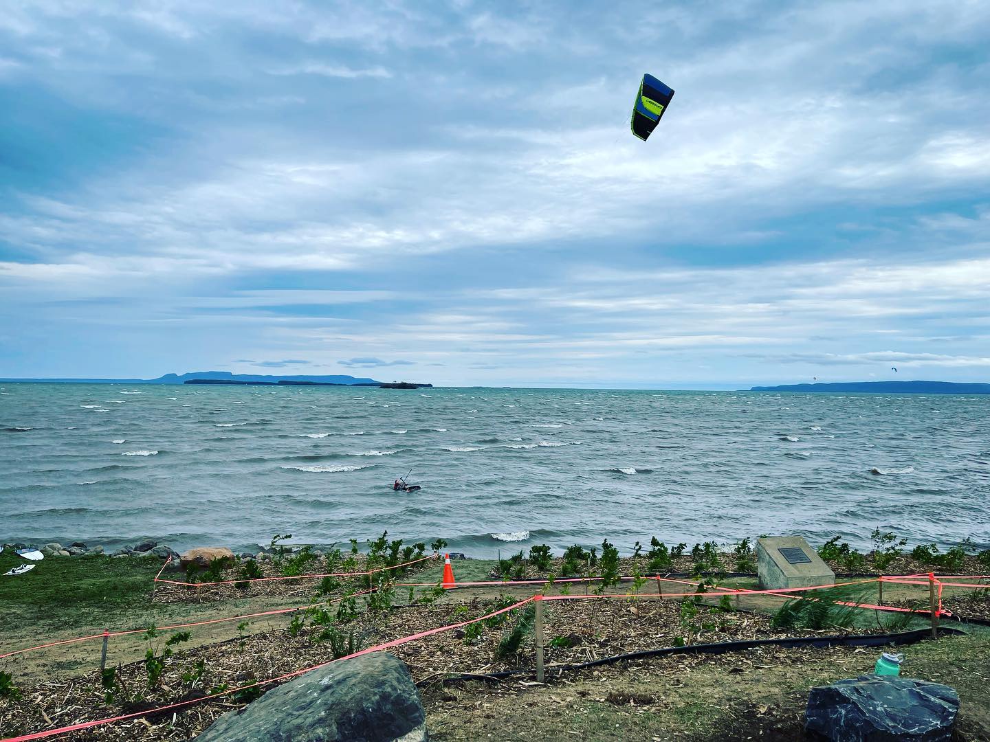
One of the best defenses against shoreline erosion is the extensive roots of native trees and shrubs. Thanks to our funders, Ministry of Northern Development, Mines, Natural Resources and Forestry, 275 native shoreline plants have been installed along the shoreline with rock protection at Mission Island Marsh Conservation Area. Access to the shoreline and views of Sleeping Giant have been maintained by installing low-lying shrubs and establishing 3-metre-wide paths to the water’s edge. On the northern side of the parking lot, lawn remains intact for the loading and unloading of kayaks, windsurfing and kite boards, and other water sports equipment.
Since being established as a Conservation Area 1988, Mission Island Marsh has seen many changes. From enhanced wildlife habitat, to the addition of viewing platforms, to natural changes along the Lake Superior shoreline. Situated in the Thunder Bay Area of Concern (AOC) – an area classified by Environment and Climate Change Canada as having experienced high levels of environmental degradation – Mission Island Marsh is one of five marshlands found along the Lake Superior Coast in the AOC. With Provincially Significant Wetland (PSW) on the property, it is essential that Mission Island Marsh Conservation Area maintain its ecosystem functions while continuing to offer the amenities the public has come to love.
Ecosystem functions are services provided by an environment to the surrounding landscape and its inhabitants. At Mission Island Marsh, some of these ecosystem services include marshland breeding area of migratory birds, wetland water level regulation, carbon storing, forest habitat for wildlife, and meadow pollinator habitat. Increased human traffic at Mission Island Marsh combined with natural erosion and storm events has caused deterioration of some of the valuable habitat found at Mission Island Marsh. Erosion along the shoreline at Mission Island Marsh is encouraged by wave action, rising water levels, and coastal storm events, and is a challenge faced by many along the Lake Superior Coast.
For more information on how you can rehabilitate the shoreline or streambank on your property, click here to learn more about our Superior Stewards Shoreline Protection Program.
The Mission Island Marsh Shoreline Rehabilitation Project was funded by the Canada-Ontario Agreement on Great Lakes Water Quality and Ecosystem Health.

Fisherman’s Park West Climate Change Awareness Park
Lakehead Region Conservation Authority has partnered with the Thunder Bay District Stewardship Council and the City of Thunder Bay to restore wildlife habitat, rehabilitate shoreline, recreate coastal wetlands, and provide passive recreation opportunities at Fisherman’s Park West. The goal of the project is to restore the park by returning the area to a more naturalized condition by planting trees, shrubs, and perennials that are native to our region. The naturalization of this area will provide valuable breeding grounds, shelter, and forage for migratory waterfowl, birds, and pollinators, while also creating a space where the public can explore and enjoy the beautiful natural landscape.
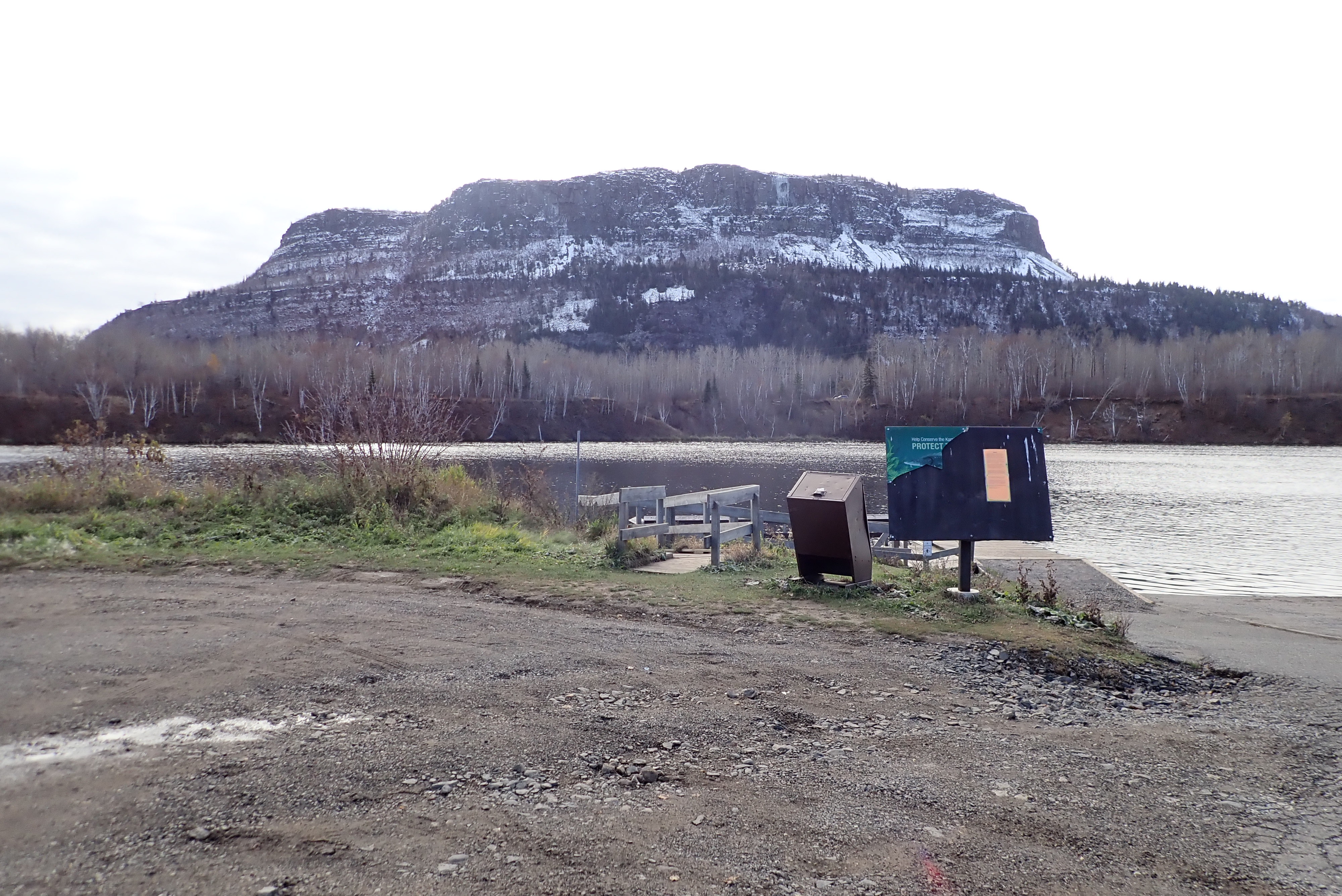
Riparian Habitat Restoration at the Mountdale Boat Launch
Lakehead Region Conservation Authority, in partnership with the City of Thunder Bay Parks & Open Spaces Section, is restoring of 1,000 square metres of riparian habitat at Mountdale Boat Launch on the Kaministiquia River by eradicating invasive species, planting native species, and implementing green infrastructure to reduce impacts from stormwater runoff. The project will improve water quality and habitat function along an important part of the river, which will advance the Fish and Wildlife Populations and Habitat beneficial uses toward redesignation.
The joint goal of LRCA and the Parks & Open Spaces Section at this phase of the project is to increase vegetation along the riverbank and add biofiltration basins to catch and filter water before it enters the Kaministiquia River. Improvements to the parking area, accessible dock, and viewing platform will be addressed as funding becomes available.
A concept plan can be viewed here and any feedback can be emailed to the “E-Mail Us” link below.
If you’re interest in being involved in upcoming site clean-ups, plantings, and volunteer events, send us an email by clicking the link below.
Special thanks to Environment and Climate Change Canada’s Great Lakes Protection Initiative and the City of Thunder Bay for funding this project.
![]()
![]()
Willdife Habitat Restoration along the Neebing-McIntyre Floodway Corridor
The restoration of 20,000 square metres of riparian habitat along the Neebing-McIntyre Floodway in the Thunder Bay Area of Concern is now underway thanks to the Great Lakes Protection Initiative funding from Environment and Climate Change Canada. Invasive species management and re-vegetation with 15,000 native perennials, shrubs and trees is planned at three sites along the Neebing-McIntyre Floodway Corridor: the Floodway Mouth, Simpson Triangle and Floodway Diversion. The project will increase biodiversity, reduce soil erosion/turbidity, and improve water quality for healthier riparian habitat to advance the Loss of Fish and Wildlife Habitat beneficial use toward redesignation.
![]()
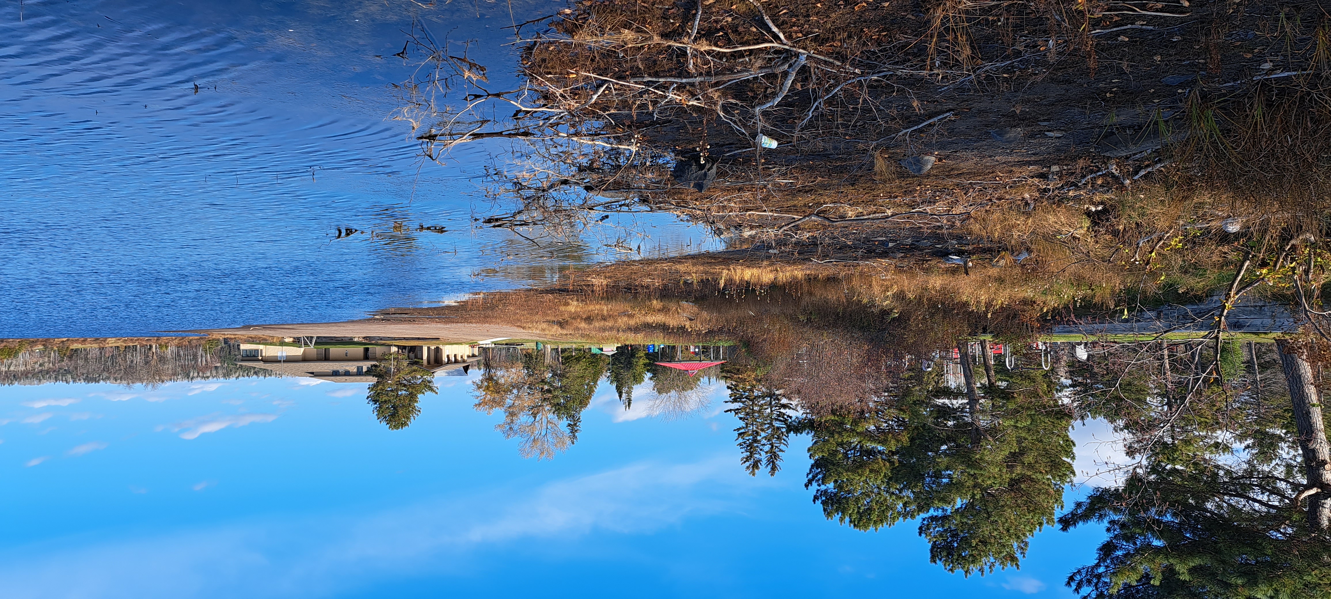
Boulevard Lake Shoreline Naturalization
In partnership with the City of Thunder Bay, and thanks to funding from Environment and Climate Change Canada’s EcoAction Community Funding program, the Lakehead Region Conservation Authority aims to rehabilitate shoreline along a stretch of Boulevard Lake just south of the new Jumpstart Inclusive Playground and the public beach. The goal is to widen and naturalize the riparian area of the shoreline to increase wildlife habitat by using plantings and some shoreline regrading. This will help increase the habitat space around the lake providing essential shelter and forage space for waterfowl, birds, and pollinators. Increasing the riparian area will also help filter runoff from the adjacent open field.