The Mid-Continent Rift
The Rove Sea
The Rove Sea was a shallow inland sea covering the region of Lake Superior, Northern Ontario and Minnesota. Fine sediments settled out over millions of years and covered up evidence of the meteorite impact. Finely layered shale rocks were formed which are termed the Rove Formation. These shales are the youngest rocks of the Animikie Group.
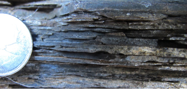
Rove Formation and Animikie Group Shales formed on the ancient sea floors. MNDM GeoTour Image.
North America Breaks Apart: A Story of Volcanoes & Earthquakes
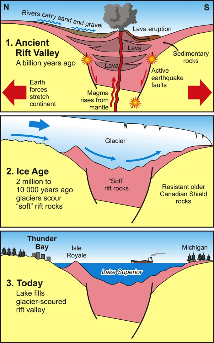
The Great Lakes Tectonic Zone forms a gigantic rift system which very nearly split North America into three pieces. The Mid Continental Rift stretches across Lake Superior near Marathon, Ontario all the way across Minnesota, Michigan, Wisconsin, Iowa, Nebraska and Kansas. Gigantic volumes of basaltic lavas poured out of the rift and can be seen today on the Keweenaw Peninsula, Isle Royale and the Black Bay Peninsula. As the area in what is now Canada tried to separate from the continental crust in the United States a 2000 kilometre long rift valley was produced.
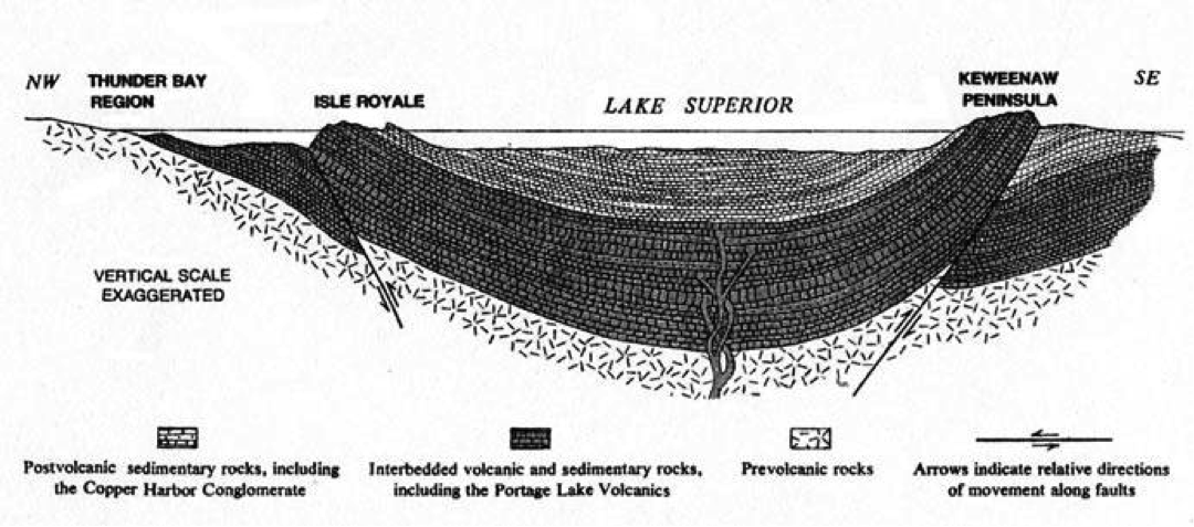
Lavas Fill the Lake Superior Rift Valley, "Keweenaw structure" by Norman King Huber, The geologic story of Isle Royale National Park, United States Geological Survey Bulletin 1309.
The Mid-Continent Rift formed the Lake Superior Basin as continent tried to split into pieces. Younger sedimentary rocks filled in on top of the volcanic rocks as the mountains eroded and rivers flowed into the rift basin. Lake Nipigon with it's towering mesas forms the third arm of the rift.
Deep Basin forms in a Rift Valley

Thunder Bay GeoTour - M.N.D.M. - Mid Continent Rift - Two arms. Lake Nipigon later formed a third arm of the rift system.
The modern day East African Rift shown in Figure 5 forms a similar geologic structure. It is split into three arms as seen in the diagram below. The Western arm of the rift system contains the "African Great Lakes" which include some of the deepest lakes in the world (up to 1,470 metres (4,820 ft) deep at Lake Tanganyika).
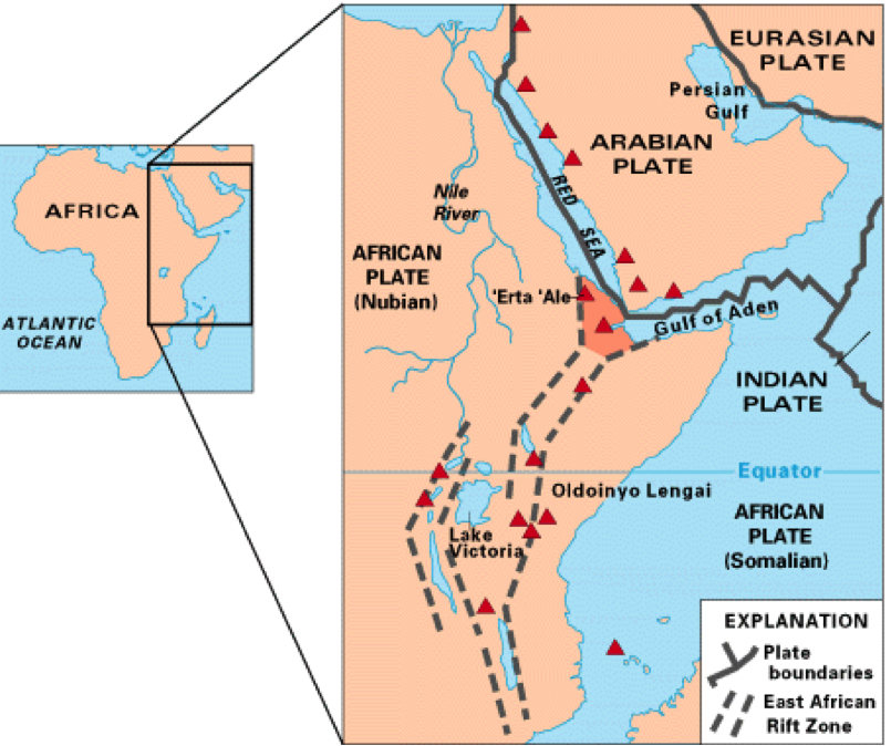
Red Sea Rift Dividing the African Plate and splitting Africa from the Arabian Plate, The African "Great Lakes" form in the south. The red triangles are volcanoes, some of which are still active in the Rift Valley. (Diagram USGS)